Rhode Island Sound Marine Forecast
| This Afternoon...N Winds 15 To 20 Kt With Gusts Up To 25 Kt. Seas 2 To 3 Ft. Wave Detail: Nw 3 Ft At 5 Seconds And S 2 Ft At 7 Seconds. Snow. Vsby 1 Nm Or Less. |
| Tonight...Nw Winds 25 To 30 Kt. Seas 4 To 6 Ft. Wave Detail: N 5 Ft At 6 Seconds And S 3 Ft At 9 Seconds. A Chance Of Snow Showers In The Evening. |
| Mon...Nw Winds 25 To 30 Kt, Diminishing To 15 To 20 Kt In The Afternoon. Seas 4 To 6 Ft. Wave Detail: N 5 Ft At 6 Seconds And S 3 Ft At 10 Seconds. |
| Mon Night...W Winds 15 To 20 Kt With Gusts Up To 25 Kt. Seas 2 To 4 Ft. Wave Detail: W 4 Ft At 5 Seconds And Ne 1 Foot At 7 Seconds. |
| Tue And Tue Night...Sw Winds 20 To 25 Kt With Gusts Up To 30 Kt. Seas 2 To 4 Ft. Wave Detail: Sw 4 Ft At 5 Seconds And Se 1 Foot At 11 Seconds. |
| Wed And Wed Night...Sw Winds 20 To 25 Kt With Gusts Up To 35 Kt, Becoming W. Seas 4 To 6 Ft. Wave Detail: Sw 6 Ft At 6 Seconds And S 6 Ft At 9 Seconds. |
| Thu...S Winds 15 To 20 Kt With Gusts Up To 25 Kt. Seas 3 To 5 Ft. |
| Thu Night...S Winds 25 To 30 Kt With Gusts Up To 40 Kt. Seas 5 To 7 Ft. Showers. Seas Are Reported As Significant Wave Height, Which Is The Average Of The Highest Third Of The Waves. Individual Wave Heights May Be More Than Twice The Significant Wave Height. |
| Area Forecast Discussion National Weather Service Boston/Norton MA 155pm EST Sunday Dec 14 2025 Synopsis A brief shot of arctic air follows a departing low pressure tonight into Monday, with wind chill values dropping to between 0 to 10 below. Cold weather continues Monday night into Tuesday but with much lighter winds. A warming trend begins Wednesday and especially by Thursday when high temperatures of 50+ are possible. Unseasonably mild temperatures will be accompanied by a round of showers sometime later Thursday into early Friday with perhaps a period of strong southerly winds and heavy rain. A brief shot of much colder weather with another period of strong winds possible later Friday into Saturday. Near Term - Through Tonight Key Messages... * Accumulating snow ends into this evening, confined mostly to southeast MA this afternoon. * Turning colder tonight. Lows in the single digits and teens. Minimum wind chill values between 0 to 10 below. A few locations towards NW MA could see wind chill values as low as 20 below. Accumulating snow had largely ended across most of RI and portions of southeast MA. As such, canceled a portion of the Winter Weather Advisory already. Will monitor the progress of the snowfall this afternoon, and perhaps cancel more of the remaining Advisory towards 4 PM. Otherwise, it will still expire at 7pm this evening. As of this writing, the heaviest snow band extended from between the Vineyard and Nantucket northeast across the outer Cape. The outer Cape is where additional accumulating snow is possible. Still expecting snowfall to diminish from NW to SE this afternoon. Will continue the Winter Weather Advisories as they are for now. Will likely be able to cancel some of these advisories prior to the 7pm expiration time. Once the snowfall ends, just turning colder with clearing skies and gusts WNW winds overnight. Considered a Cold Weather Advisory towards the Berkshires, but thinking the colder conditions will not be widespread enough to warrant a headline. This will need to be monitored this evening. Short Term - Monday Through Monday Night Key Messages... * Gusty WNW winds through Monday * Dry weather with below normal temperatures A sprawling high pressure over the central USA will maintain dry and cold conditions across southern New England into Monday night. Some sunshine to start the day, with increasing clouds during the afternoon. Mostly cloudy skies expected Monday night, but not much in the way of precipitation. There is a low chance for a stray snow shower from the Great Lakes to make it into the Berkshires Monday Night. Long Term - Tuesday Through Sunday Key Messages... * Dry & chilly Tue. Highs mainly in the lower to middle 30s * Turning milder Wednesday with continued dry weather & highs into the 40s * Showers with heavy rain & potential briefly strong southerly wind gusts later Thu into early Fri with unseasonably mild temps * Brief shot of much colder temps returns behind the front later Fri into Sat with another round of strong winds possible Details... Tuesday... Still chilly Tue, but with light winds. Highs on Tuesday will range from the upper 20s in the highest terrain to mainly the lower to middle 30s elsewhere. Wednesday... The developing -PNA and high pressure to our south sliding further east will allow for the beginning of a pattern change and milder temperatures. While it will remain dry on Wed, gusty southwest winds developing will push high temperatures well into the 40s. Thursday into Friday morning... Strong shortwave energy over the northern plains will move eastward into the Great Lakes. As this happens, strong surface low pressure perhaps sub 980 mb will pass well to our north across Quebec. Given the potential strength of the surface low pressure system...the long range guidance is indicating a strong southerly LLJ nearly 3 standard deviations outside climatology. Not only will this bring up unseasonably mild temperatures and PWATs (Precipitable Waters) exceeding 1 inch. This will combined with strong forcing ahead of the cold front and bring showers with perhaps brief heavy rain sometime later Thu into Fri. In addition...given the magnitude of the southerly LLJ we will have to watch for a brief period for strong surface wind gusts if the inversion is able to mix out. It is way too early to assess that...but depending on the timing temperatures may rise well into the 50s Thu night/early Fri and may even flirt with 60 degrees. If we are able to get mild enough...the potential for a period of strong winds to be realized will increase. Again...way too early to say much more than that but something to watch in the coming days. Later Friday into Saturday... Briefly turning much colder later Friday into Saturday behind the cold front. Mainly dry weather expected, but another period of strong winds this time from the west is possible immediately behind the cold front. Marine Forecaster Confidence Levels... Low - less than 30 percent. Moderate - 30 to 60 percent. High - greater than 60 percent. Through Monday Night...High confidence. Winds quickly increase to gales this evening as colder air arrives and continues into Monday. Expecting wind gusts between 35-40 kt later this evening into Monday afternoon. Areas of very light freezing spray possible tonight and Monday. Elsewhere, Small Craft Advisory conditions expected in Narragansett Bay and Boston Harbor. Outlook /Tuesday through Friday/... Tuesday: Winds less than 25 kt. Seas locally approaching 5 ft. Tuesday Night: Low risk for Small Craft Advisory winds with gusts up to 30 kt. Seas locally approaching 5 ft. Wednesday: Strong winds with gusts up to 30 kt. Areas of rough seas. Wednesday Night: Winds less than 25 kt. Areas of rough seas. Thursday: Winds less than 25 kt. Areas of seas approaching 5 ft. Thursday Night: Moderate risk for gale force winds with areas of gusts up to 45 kt. Areas of rough seas. Rain likely. Friday: gale force winds with gusts up to 45 kt. Rough seas up to 12 ft. Chance of rain. NOAA Boston MA Office: Watches - Warnings - Advisories CT...None. MA...Winter Weather Advisory until 7pm EST this evening for MAZ020>024. RI...Winter Weather Advisory until 7pm EST this evening for RIZ008. Marine Small Craft Advisory until 3pm EST Monday for ANZ230-236. Gale Warning from 7pm this evening to 1pm EST Monday for ANZ231>235-237-250-251-254>256. |
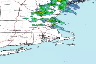 Boston MA Radar
 Northeast Radar
 East Coast Satellite