Savannah, GA to Altamaha Sound, GA including Grays Reef National Marine Sanctuary Marine Forecast
| Today...Sw Winds 5 To 10 Kt, Becoming S 10 To 15 Kt With Gusts To 20 Kt This Afternoon. Seas 2 To 3 Ft. Wave Detail: Se 3 Ft At 5 Seconds And E 1 Foot At 11 Seconds. |
| Tonight...S Winds 15 To 20 Kt, Becoming Sw 10 To 15 Kt After Midnight. Seas 3 To 4 Ft. Wave Detail: S 3 Ft At 5 Seconds And E 1 Foot At 10 Seconds. |
| Thu...Sw Winds 10 To 15 Kt, Becoming S 15 To 20 Kt In The Afternoon. Seas 2 To 3 Ft. Wave Detail: S 3 Ft At 6 Seconds And E 1 Foot At 11 Seconds. A Slight Chance Of Showers And Tstms In The Afternoon. |
| Thu Night...Sw Winds 10 To 15 Kt. Seas 2 To 3 Ft. Wave Detail: S 3 Ft At 5 Seconds And E 1 Foot At 11 Seconds. Showers And Tstms Likely. |
| Fri...Sw Winds 10 To 15 Kt With Gusts To 20 Kt. Seas 2 To 3 Ft. Wave Detail: S 3 Ft At 6 Seconds And E 1 Foot At 11 Seconds. Showers And Tstms Likely. |
| Fri Night...W Winds 10 To 15 Kt, Becoming N 15 To 20 Kt After Midnight. Seas 2 To 3 Ft. Wave Detail: W 2 Ft At 4 Seconds And S 2 Ft At 6 Seconds. Showers And Tstms Likely, Mainly In The Evening. |
| Sat...N Winds 10 To 15 Kt. Seas 2 To 3 Ft. |
| Sat Night...W Winds 5 To 10 Kt. Seas 2 Ft. |
| Sun...Nw Winds 5 To 10 Kt. Seas 1 Foot Or Less. |
| Sun Night...S Winds 10 Kt. Seas 1 Foot Or Less. Winds And Seas Higher In And Near Tstms. |
| Area Forecast Discussion National Weather Service Charleston SC 743am EDT Wednesday May 8 2024 Synopsis Atlantic high pressure will remain across the region today. A cold front will approach the area Thursday night and push offshore Friday bringing cooler conditions for the weekend. Near Term - Through Tonight IR satellite indicated that a deck of debris cirrus will across the I-26 corridor this morning. Otherwise, sky conditions should remain mostly to partly sunny today. The H5 ridge axis along the coast this morning will shift east today, with broad ridging remaining across the forecast area. The CWA (County Warning Area) will remain under a surface ridge, with the high center south of Bermuda. Winds should remain from the southwest this morning, shifting from the south-southwest along the coast in the wake of a mid to late afternoon sea breeze. Given strong insolation, warm llevel thicknesses, SSW winds, and a late sea breeze, high temperatures are forecast to reach the low to mid 90s this afternoon. In fact, the temperatures could challenge record highs, especially at KCHS, see Climate section below. Conditions are forecast to remain dry under the broad H5 ridge and MLCIN remaining between 10-25 J/kg through this afternoon. Tonight: A slight H5 ridge should remain across the forecast through tonight. However, the 0Z HREF indicates that MCSs will continue to track across NC and portions of SC just south of the NC/SC state line. This convection may be close enough to observe lightning flashes to the north tonight, but should remain outside the forecast area. Low temperatures are forecast to range from around 70 inland to the low to mid 70s along the coast. Short Term - Thursday Through Saturday Thursday and Friday: A cold front extending from low pressure over the Ohio Valley will approach the area during the day. While the morning and early afternoon appears to be dry, ongoing convection spanning across the Tennessee Valley and into the Deep South should push toward the east. With a potential MCV (Mesoscale Cyclonic Vortice, a low-pressure center in a group of thunderstorms, that pulls winds into a circling pattern, or vortex) upstream, it is still quite uncertain when/if convection will move into the forecast area. The NAM still depicts a drier forecast with storms falling apart across the Midlands and only isolated convection headed toward the forecast area. Meanwhile the hi-res models point to a squall line/ cluster of storms pushing southeast across the CWA. As far as timing goes, models are beginning to trend toward a late afternoon/early evening arrival time with most initial activity offshore by midnight. Nonetheless, the environment will be supportive of strong to severe storms Thursday with destabilization occurring early, resulting in MLCAPE values in excess of 1500 J/kg. Steep lapse and nearly unidirectional 0-6 km shear on the order of 40-50 knots could set the stage for a large hail and damaging wind threat. Although any storms should be rather progressive in movement, PWATs (Precipitable Waters) near 2" could result in locally heavy downpours with intense rain rates in the core of the cells. The cold front is not expected to clear the area until later on Friday, thus we could see another round of convection moving in some time between early Friday morning and Friday afternoon. Again, this is highly uncertain with signals of yet another MCV propagating across southern MS/AL/GA, which could greatly alter the downstream environment. Given the earlier timing for shower/thunderstorms, it is also unclear how the severe threat (if any at all) will pan out Friday. Temperatures Thursday will reach the low/mid 90s. Heat indices could approach the triple digits especially across southeast Georgia, but are expected to remain below our Heat Advisory threshold. Overnight will be mild, only dipping into the upper 60s/low 70s. Friday will be slightly cooler due to potentially ongoing convection and/or cloud cover, with highs in the mid to upper 80s. The FROPA will cause temperatures to significantly drop Friday night, with lows in the mid to upper 50s inland and lower 60s along the coast. Saturday: A cooler and dry air mass will move into the area in the wake of the front bringing rain-free conditions. Mostly sunny skies are expected with highs peaking in the upper 70s to low 80s. trong> A modest warm up for Sunday will bring temperatures back into the low to mid 80s with another day of mostly sunny skies. The forecast becomes more uncertain early next week as model guidance suggests that southern stream energy could move across the Deep South along a residual boundary. Conditions could end up becoming quite unsettled, or the bulk of the rainfall and convection could slide south of the area. For now we have rain chances capped at slight chance through mid next week. Marine The marine zones will remain under a ridge of surface high pressure today and tonight. Winds should remain from the southwest between 10 to 15 kts, gusts around 20 kts will be possible tonight. Seas should gradually build through today into tonight, ranging between 2-3 ft this morning and reaching 3-5 ft tonight. Thursday through Friday: A strong cold front will approach Thursday causing SW winds to increase. Marginal Small Craft Advisory conditions are likely Thursday evening as gusts approach 25 kt, and again Friday night behind the FROPA. At this time, the Charleston County nearshore waters out to 20nm look the most promising for any advisories that could be needed. Another forecast issue for the local waters will be the potential for strong thunderstorms Thursday evening through Friday afternoon. The timing of thunderstorms remains unclear, but any storms that do develop and move across the waters will be capable of producing strong wind gusts. Saturday through Monday: Marine conditions will rapidly improve this weekend as weak high pressure builds in from the west. By Saturday, winds will drop to 10-15 kt and seas to 3 ft or less through Monday. Rip Currents Tybee Island observed around a dozen rip currents on Tuesday. Today, wave heigheights may peak around a foot higher than yesterday, continuing with swell periods of 10-11 seconds. In addition, today is the new Moon, increasing astronomical tides. Based on the recent observed rip currents and increase breakers heights, a moderate risk for rip currents has been posted for the GA beaches today. Tides / Coastal Flooding The New Moon today and recent Perigee (May 5) will lead to elevated astronomical tides over the next few days. Minor coastal flooding is possible along Charleston and coastal Colleton Counties, including downtown Charleston, during the evening high tides today and Thursday. Climate Record High Temperatures: May 8: KCHS: 93/1986 KSAV: 96/1986 May 9: KCHS: 95/1963 KSAV: 95/1962 NOAA Charleston SC Office: Watches - Warnings - Advisories GA...None. SC...None. Marine None. |
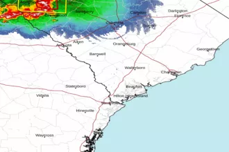 Charleston SC Radar
 Southeast Radar