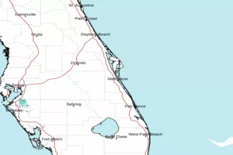
Sebastian Inlet to Jupiter Inlet out 20nm Marine Forecast
| Rest Of Today...South Winds 5 To 10 Knots, Becoming Southeast 10 To 15 Knots This Afternoon. Seas 2 To 3 Feet. Wave Detail: Southeast 3 Feet At 4 Seconds And Northeast 3 Feet At 11 Seconds. A Moderate Chop On The Intracoastal Waters. |
| Tonight...South Winds 10 To 15 Knots. Seas 3 Feet. Wave Detail: Southeast 3 Feet At 4 Seconds And Northeast 3 Feet At 11 Seconds. A Light Chop On The Intracoastal Waters. |
| Thursday...South Winds 10 To 15 Knots, Becoming Southeast 15 To 20 Knots In The Afternoon. Seas 3 To 4 Feet. Wave Detail: Southeast 3 Feet At 4 Seconds And Northeast 3 Feet At 12 Seconds. Choppy On The Intracoastal Waters. |
| Thursday Night...South Winds 15 To 20 Knots, Becoming Southwest 10 To 15 Knots After Midnight. Seas 3 To 4 Feet. Wave Detail: Southeast 4 Feet At 4 Seconds And Northeast 2 Feet At 11 Seconds. Choppy On The Intracoastal Waters. |
| Friday...Southwest Winds 10 To 15 Knots, Becoming West After Midnight. Seas 2 To 3 Feet. Wave Detail: South 2 Feet At 4 Seconds And Northeast 2 Feet At 11 Seconds. A Light Chop On The Intracoastal Waters. A Slight Chance Of Showers And Thunderstorms In The Afternoon And Evening. A Chance Of Showers With A Slight Chance Of Thunderstorms After Midnight. |
| Saturday...Northwest Winds Around 10 Knots, Becoming Northeast In The Afternoon And Evening, Becoming Northwest After Midnight. Seas 2 To 3 Feet. Wave Detail: North 2 Feet At 4 Seconds And Southeast 1 Foot At 3 Seconds. Mostly Smooth On The Intracoastal Waters. A Chance Of Showers With A Slight Chance Of Thunderstorms, Then A Slight Chance Of Showers And Thunderstorms In The Evening. |
| Sunday...North Winds 5 To 10 Knots, Becoming Southeast After Midnight. Seas 2 To 3 Feet. Mostly Smooth On The Intracoastal Waters. A Slight Chance Of Showers And Thunderstorms. Winds And Waves Higher In And Near Thunderstorms. |
| Area Forecast Discussion National Weather Service Melbourne FL 936am EDT Wednesday May 8 2024 Marine Issued at 937am EDT Wednesday May 8 2024 Currently-Today... High pressure over the western Atlantic continues to influence the stat of Florida. Favorable boating conditions are forecast to become poor into this evening with increasing south to southwest winds at 15-20kts. Seas are forecast to build to 2-3ft with up to 4ft over the Brevard and Volusia county waters into the overnight hours. .PREVIOUS Issued at 418am EDT Wednesday May 8 2024 Key Messages: -Near Record High Temperatures Today through Friday. -Fire Weather Danger Increasing Into Late Week. Today/Tonight...High pressure in control at the surface and aloft will produce unseasonably hot temperatures across most of the area. The low level ridge axis, currently draped across central FL will continue to drift southward and promote a light S/SW flow. This will slightly delay onset of the sea breeze so max temps will be a little warmer along the immediate coast (upper 80s). The high pressure ridge aloft will produce subsident warming and drying and produce widespread mid 90s across the interior and inland portions of the coastal counties. A sea breeze collision will occur again early this evening, slightly east of where they collided yesterday over the north interior. Added a small Probability of Precipitation (20 percent or less) for this collision a couple hours either side of sunset. The prospect for thunder is quite low given unimpressive lapse rates and rather warm 500 mb temps -6 to -6.5C thanks to the suppressive effects of the ridge aloft. The sea breeze convection will dissipate before midnight with a quiet, mild overnight. Peak heat indices are forecast to reach 99-101 across the interior counties and inland portions of the coastal counties with mid 90s along the coast. While these conditions are fairly common during FL summers and are below Heat Advisory criteria, most are not yet acclimated to the heat this season. For those exposed to the direct sun for extended periods, this heat can be dangerous to anyone without proper hydration or access to adequate cooling breaks. Thursday-Friday...Very hot. The mid-upper level ridge continues building across Florida Thursday afternoon, before getting flattened and displaced southwest a bit by a substantial mid-level trough over the central and eastern US Friday. At the surface, high pressure draped across the subtropical Atlantic is shunted to the southeast by an approaching cold front, resulting in low-level flow SSW-SW Thursday and SW-WSW Friday. Combined with subsidence from deeply stacked high pressure, afternoon highs Thursday are forecast to soar into the M-U90s inland and coastal Volusia, while the rest of the coastal corridor holds short "only" in the U80s-L90s thanks to the sea breeze eventually developing (it will be delayed and pinned due to southwesterly flow). Friday will see temperatures drop a few degrees for many as the influence of high pressure wanes, but southwesterly winds becoming breezy ahead of the approaching cold front will likely pin the east coast sea breeze offshore, while the west coast sea breeze races across the peninsula, resulting in very gusty and warn westerly winds by the late afternoon and evening, especially the northern half of ECFL. Highs inland from roughly Titusville to Kissimmee north in the L-M90s thanks to clouds from the approaching front, while down south highs remain very hot in the M-U90s. Without a sea breeze, Friday will be the hottest day for the southern coastal corridor, reaching the M90s. Better agreement on timing and shower/storm chances with the aforementioned approaching cold front as the ECM solution converges on the GFS, calling for the front to approach ECFL late Friday morning or afternoon, stall a bit, then push through late Friday through early Saturday morning, finally departing to the south by Saturday afternoon. With PWATs (Precipitable Waters) topping out at just 1.5" and generally lower, have kept Probability of Precipitation to 20-40 pct (highest to the north), starting in the late morning as the front approaches, increasing to highest chances/coverage in the late afternoon to evening, then decreasing overnight as moisture decreases while the front moves south. Global models keep the environment capped with a 850-700mb inversion until after the front passes late Friday night, but said global models haven't been doing great with mesoscale develop over Florida this past week, so won't rule out isolated lightning storms, or even a strong storm or two, especially with 500mb temps do drop to -11C and MUCAPE up to 1500 J/kg). Stronger storms would be capable of frequent cloud to ground lightning, gusty winds, and locally heavy downpours. Saturday-Wednesday...More confidence in the weekend forecast than the last couple packages. Broad, subtle mid-level troughing Saturday becomes zonal Sunday and Monday, then a mid-level low/shortwave looks to make a pass as the Southeast US mid-week. At the surface, deterministic models get pretty messy, but pretty good ensemble agreement high pressure behind the front will track east across the Southeast through the weekend, keeping the frontal boundary south of us, then depart offshore by Monday. We'll still have sufficient moisture and upper level support for isolated showers and lightning storms Saturday, mainly across the southern half of ECFL, but then dry out again Sunday. As the high moves into the western Atlantic, the southerly to southwesterly flow along the western flank lifts the stalled frontal boundary and associated moisture back north across central Florida Monday, where it will likely remain through much of the week and hopefully bring Florida some much needed rain. Depending on how far south mid-level shortwaves and impulses of energy make it, we could potentially see higher coverage of lightning storms than we've had in quite a while towards mid-week. Forecast is now suggesting we'll stay warmer through the period than previously advertised, with most areas still getting into the 90s Saturday, and only making it down to the U80-L90s by Wednesday. Overnight lows in the U60-L70s. Marine Issued at 418am EDT Wednesday May 8 2024 Thursday-Sunday...High pressure draped from the Atlantic subtropics to Florida, with the ridge axis across south Florida Thursday, retreats seaward Friday ahead of an approaching cold front. The cold front is forecast to reach the local Atlantic waters late Friday, with isolated showers and lighting storms possible along and ahead of the front, pushing through overnight into Saturday morning, and departing to the south Saturday afternoon where it will stall through the rest of the weekend as high pressure fills in behind. Wind continuously changing through most of the period as gradient winds veer from SSW-SW Thursday to SW-WSW Friday, NW-WNW Saturday behind the front, and Sunday N-NE shift to the SSE-SE Thursday, S-SW Friday, NE-E Saturday, and E-SE Sunday as the sea breeze develops. Winds generally 10-15 kts from the early morning through the afternoon, except Thursday and Friday evenings when wind surges cause speeds to increase to 15-20 kts through most of the overnight. Small craft should exercise caution during these times. Winds generally 5-10 kts after the front passes. Isolated to scattered showers and isolated lightning storms possible across the Atlantic waters through the weekend. Fire Weather Issued at 418am EDT Wednesday May 8 2024 Today...Fire sensitive conditions will continue as min RH values are forecast to reach 35-40 percent this afternoon across the interior with S/SW winds 5-10 mph. Min RH values will hold between 45-55 percent along the coast due to effects of the sea breeze. Winds behind the sea breeze will increase 15-20 mph with gusts up to 30 mph which could produce rapid spread of any new or ongoing fires despite the higher RH values. Friday - Sunday Sensitive fire weather conditions continue through the weekend as Florida generally remains under the influence of high pressure. Min RHs Thursday 30-40 pct inland, but SW winds forecast to remain less than 15 mph. Min RHs as low as 30-40 pct and SW to W winds increasing to 15-20 mph with gusts up to 30 mph Friday ahead of an approaching front will result in a very sensitive fire weather day. Isolated lightning storms will be possible as the front pushes through late Friday into early Saturday, but won't provide any substantial rainfall. Min RHs inland Saturday behind the front 30-40 pct and Sunday 25-35 pct. Winds decrease to 10-15 mph Saturday and 5- 10 mph Sunday (picking back up to 10-15 mph near the coast with the sea breeze) Sunday, continuing sensitive fire weather conditions, but hopefully remaining below critical conditions. Climate Record highs Today, Thu and Fri. DAB 8-May 94 1967 LEE 8-May 94 2009 SFB 8-May 95 2009 MCO 8-May 98 1915 MLB 8-May 93 1975 VRB 8-May 92 2006 FPR 8-May 94 1967 DAB 9-May 94 1978 LEE 9-May 96 2009 SFB 9-May 97 2009 MCO 9-May 98 1915 MLB 9-May 94 1978 VRB 9-May 93 1977 FPR 9-May 95 1967 DAB 10-May 94 2008 LEE 10-May 96 2009 SFB 10-May 98 2009 MCO 10-May 98 1916 MLB 10-May 95 1978 VRB 10-May 95 1976 FPR 10-May 96 2008 NOAA Melbourne FL Office: Watches - Warnings - Advisories FL...None. AM...None. |
 Melbourne Radar
 Southeast Radar