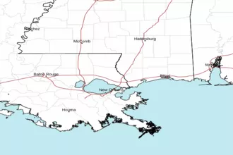
Southwest Pass of the Mississippi River to Port Fourchon Louisiana Marine Forecast
| Rest Of Tonight...South Winds 10 To 15 Knots. Seas 2 To 3 Feet. Wave Detail: South 3 Feet At 6 Seconds. |
| Wednesday...South Winds 10 To 15 Knots With Gusts Up To 20 Knots. Seas 2 To 4 Feet, Occasionally To 5 Feet. Wave Detail: South 4 Feet At 6 Seconds. |
| Wednesday Night...South Winds 10 To 15 Knots With Gusts Up To 20 Knots. Seas 2 To 4 Feet, Occasionally To 5 Feet. Wave Detail: South 4 Feet At 6 Seconds. |
| Thursday...South Winds 10 To 15 Knots. Seas 2 To 4 Feet, Occasionally To 5 Feet. Wave Detail: South 4 Feet At 6 Seconds. |
| Thursday Night...South Winds 10 To 15 Knots. Seas 2 To 4 Feet, Occasionally To 5 Feet. Wave Detail: South 4 Feet At 7 Seconds. A Slight Chance Of Showers And Thunderstorms After Midnight. |
| Friday...Southwest Winds 5 To 10 Knots, Becoming Northwest In The Afternoon. Seas 2 To 4 Feet, Occasionally To 5 Feet. Wave Detail: South 4 Feet At 7 Seconds. A Slight Chance Of Showers And Thunderstorms In The Morning. |
| Friday Night...North Winds 5 To 10 Knots, Becoming Northeast 10 To 15 Knots With Gusts Up To 20 Knots After Midnight. Seas Around 2 Feet. Wave Detail: Northeast 2 Feet At 3 Seconds And South 2 Feet At 6 Seconds. |
| Saturday...East Winds 10 To 15 Knots. Seas 2 To 3 Feet. Wave Detail: Northeast 2 Feet At 3 Seconds And South 2 Feet At 6 Seconds. |
| Saturday Night...Southeast Winds 5 To 10 Knots. Seas 1 To 2 Feet. Wave Detail: Southeast 2 Feet At 6 Seconds. |
| Sunday...East Winds 5 To 10 Knots, Becoming Southeast 10 To 15 Knots In The Afternoon. Seas 1 To 2 Feet. Wave Detail: Southeast 2 Feet At 5 Seconds. A Slight Chance Of Showers. A Slight Chance Of Thunderstorms In The Afternoon. |
| Sunday Night...Southeast Winds 10 To 15 Knots. Seas 2 To 3 Feet. A Slight Chance Of Thunderstorms. A Slight Chance Of Showers In The Evening, Then A Chance Of Showers After Midnight. Winds And Seas Higher In And Near Thunderstorms. |
| Area Forecast Discussion National Weather Service New Orleans LA 1154pm CDT Tuesday May 7 2024 Long Term (Thursday through Monday night) Issued at 330pm CDT Tuesday May 7 2024 A fast moving southern stream vorticity max and associated 125 knot jet streak will move into the area by Thursday evening. In advance of this system, continued subsidence associated with a departing ridge axis will allow daytime highs to once again climb into the upper 80s and lower 90s, and a few record highs will likely be tied or broken. These warm surface temperatures will combine with cooling temperatures aloft to induce very steep mid- level lapse rates in excess of 7.0 C/km by the afternoon and evening hours. The primary result of these steep lapse rates will be very high MLCAPE values of 2500 to 3000 J/KG Thursday afternoon into Thursday evening. Additionally, a surge of Pacific based upper level moisture will also rapidly feed into the area as the jet streak moves in. This will increase PWATs (Precipitable Waters) by nearly half an inch over the course of Thursday, and values will be approaching 2 inches by the evening hours. The combination of deeper moisture, ample instability, and deep layer forcing from the passing vort max will result in deeper convective updrafts and eventually shower and thunderstorm activity. As a result, fairly high rain chances of 50 to 70 percent are forecast Thursday evening into Thursday night. Another factor to review is the wind field and shear parameters in place. Low level winds are expected to be from the south and south-southwest at 10 to 15 knots. However, mid- level winds will be more southwesterly at 30 to 40 knots, and this will push storm relative helicity values upward to between 150 and 200 m2/s2. The strong jet streak moving through will also push effective bulk wind shear values to between 50 and 60 knots. The combination of these factors will support both tilting and splitting updrafts, and a few discrete supercells may form within a larger convective complex. All severe threats will be possible including large hail, strong damaging wind gusts, and a few tornadoes Thursday evening into Thursday night. Conditions will begin to improve on Friday as the jet streak moves to the east and increasing upper level subsidence takes hold of the area. Lingering convection over eastern zones in the morning will give way to clearing skies and dry conditions by the afternoon hours. A cooler airmass will also begin to move into the area, and highs will be closer to average in the low to mid 80s Friday afternoon. The warmest readings will be along coastal Mississippi where downslope compressional heating on the back of a northerly wind flow can is expected. Saturday and Sunday will be mainly clear and dry as a very stable ridge of high pressure dominates the Gulf South, and temperatures will be largely near average. Overall, have stuck with the NBM deterministic output over this period. Heading into Monday, model guidance has come into better agreement that a southern stream shortwave trough will begin to impact the area. A broad area of increasing positive vorticity advection and favorable jet dynamics will support higher rain chances and the threat of some elevated convection along a weakening frontal boundary Monday into Monday. Greater confidence in this solution will occur if subsequent model runs continue to remain in good agreement. Overall, have stuck with the NBM output until confidence increases further. Marine Issued at 330pm CDT Tuesday May 7 2024 Southeast flow of 10 to 15 knots will persist on the southwest periphery of a high pressure system through tomorrow. Winds will briefly increase on Thursday as frontal boundary increases the pressure gradient over the Gulf with values of 15 to 20 knots and seas of up to 5 feet expected. There will also be the risk of convection producing strong wind gusts Thursday night in advance of the front. After the front moves through on Friday, winds will shift to the north and gradually decrease back to 10 to 15 knots by Friday night. Fairly benign conditions are then expected for the upcoming weekend with light winds of 10 knots or less and calm seas. NOAA New Orleans LA Office: Watches - Warnings - Advisories LA...None. GM...None. MS...None. GM...None. |
 New Orleans LA Radar
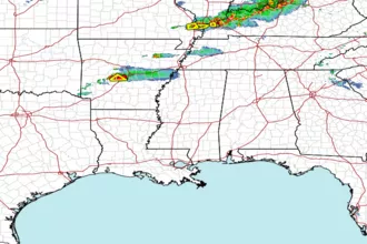
 Gulf Radar