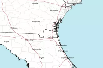
St. Augustine to Flagler Beach, FL 20 - 60 NM Marine Forecast
| Rest Of Tonight...South Winds Around 15 Knots, Becoming Southwest Late. Seas 3 To 4 Feet, Occasionally To 5 Feet. Wave Detail: South 3 Feet At 6 Seconds And East 2 Feet At 12 Seconds. |
| Wednesday...Southwest Winds Around 10 Knots, Becoming South In The Afternoon. Seas Around 3 Feet. Wave Detail: Southeast 3 Feet At 5 Seconds And East 2 Feet At 11 Seconds. |
| Wednesday Night...South Winds 15 To 20 Knots. Seas 3 To 5 Feet, Occasionally To 6 Feet. Wave Detail: South 4 Feet At 5 Seconds And East 2 Feet At 11 Seconds. |
| Thursday...South Winds 10 To 15 Knots. Seas 3 To 4 Feet, Occasionally To 5 Feet. Wave Detail: Southeast 3 Feet At 6 Seconds And East 2 Feet At 11 Seconds. |
| Thursday Night...Southwest Winds 15 To 20 Knots, Diminishing To 10 To 15 Knots After Midnight. Seas 3 To 4 Feet, Occasionally To 5 Feet. Wave Detail: South 4 Feet At 6 Seconds And Southwest 2 Feet At 3 Seconds. A Chance Of Showers With A Slight Chance Of Thunderstorms. |
| Friday...Southwest Winds 10 To 15 Knots, Increasing To 15 To 20 Knots In The Afternoon. Seas 3 To 4 Feet, Occasionally To 5 Feet. Wave Detail: South 3 Feet At 5 Seconds. Showers Likely With A Slight Chance Of Thunderstorms. |
| Friday Night...West Winds 15 To 20 Knots, Becoming Northwest 10 To 15 Knots After Midnight. Seas 3 To 4 Feet, Occasionally To 5 Feet. A Chance Of Showers And Thunderstorms. |
| Saturday...Southeast Winds 10 To 15 Knots. Seas 2 To 3 Feet. Winds And Seas Higher In And Near Thunderstorms. |
| Sunday...Southeast Winds 10 To 15 Knots. Seas 2 To 3 Feet. Winds And Seas Higher In And Near Thunderstorms. |
| Area Forecast Discussion National Weather Service Jacksonville FL 835pm EDT Tuesday May 7 2024 ...New Issued at 824pm EDT Tuesday May 7 2024 For the latest NE FL and SE GA Daily Key Messages please visit: https://www.weather.gov/media/jax/briefings/nws-jax-briefing.pdf East Coast/Gulf Coast sea breeze merger taking place along the US 17 corridor/St. Johns River Basin at the moment and just expect a few brief light showers/sprinkles through 10pm, otherwise skies becoming mostly clear for all NE FL/SE GA locations by the overnight hours. Low level SW flow will increase moisture enough to develop low clouds and patchy fog across inland NE FL, mainly along the I-75 corridor towards sunrise Wednesday morning. Lows generally in the upper 60s inland and lower 70s along the coast. Mid level ridge axis holds in place across the region on Wednesday with enough subsidence to suppress convection for the most part and rainfall chances remain at 10% or less. The Southwest flow will pin the East Coast sea breeze to the I-95 corridor and the heat will build throughout the day reaching the middle 90s from the I-95 to US 301 corridors with Heat Indices (HI) peaking around 100 degrees, while the Atlantic Coastal Beaches should top out around 90 degrees. Near Term Issued at 301pm EDT Tuesday May 7 2024 For the latest NE FL and SE GA Daily Key Messages please visit: https://www.weather.gov/media/jax/briefings/nws-jax-briefing.pdf Mostly dry conditions with only an isolated shower offshore near midday. The inland push of the sea breeze will be limited today as high pressure builds into the region, chances of isolated showers and storms will mainly be confined along the I-95 corridor in NE FL. Main threat concerns for any isolated t'storm would be occasional to frequent lightning, gusty winds, and brief heavy rainfall. By early evening, any shower/storm activity should clear out leading to skies becoming mostly clear across the area. Patchy fog will be possible along the western edges of our area past midnight and clear out by sunrise. Overnight lows are expected to dip to the mid 60s over inland areas and in the low 70s along the coast. .SHORT TERM... (Wednesday through Thursday night) Issued at 301pm EDT Tuesday May 7 2024 The overall pattern Wednesday and Thu shows an upper level ridge across most of the forecast area and into the Gulf of Mexico, with some mid level troughing moving in Thursday afternoon, with the upper level ridge axis beginning to shift east of the area Thursday night. At the sfc, high pressure ridge is over the central FL peninsula and will move a bit southward by Thu to southern FL, as a cold front marches east to southeast from the TN and MS valley to Appalachians. The airmass will remain dry and hot for Wednesday and partly on Thu with 850 mb temps rising to about 19C and thicknesses that support mid 90s over the eastern zones. Hottest temps look to be over the eastern zones as the southwest winds, breezy at times, near 15 mph gusting to 25 mph, push the hot air all the way to the coast. In other words, the east coast sea breeze is going to be hard pressed to move inland, especially on Thursday. Heat indices likely to top out around 100-103 or so. Record highs are possible. Not heat advisory criteria but if not used to heat since it's a bit early in the year for it, it will be sensitive to more vulnerable people or those working outdoors. Models show a decent shot of some showers and storm coming in from the west, mainly affecting southeast GA, Thursday afternoon and night, with the ECMWF (European Centre for Medium-Range Weather Forecasts) developing convection faster than the GFS. GFS (Global Forecast System) eventually brings in a batch of showers and potential storms (MCS (Mesoscale Convective System, a complex of thunderstorms which becomes organized on a scale larger than the individual thunderstorms) type feature) by early Friday morning. Latest trend in the GFS is for somewhat better chances of precipitation Thu night compared to prior runs. Latest forecast shows a slight uptick in chances Long Term (Friday through next Tuesday) Issued at 301pm EDT Tuesday May 7 2024 Cold frontal boundary will sag southward over the region Friday as mid to upper level trough moves through the region. Uncertainty on how things evolve early Friday and through the afternoon. Current forecast shows showers and storms widespread over the north half of the area and more scattered to numerous further south. Latest model output suggests we may need to shift the higher POPs further south into northeast FL but will wait on further model agreement. The mid level trough moves east of the area by Friday evening and helps to push the cold front through our forecast area. Lingering precipitation will be possible Friday evening but the front should end up over central FL late Friday night into Saturday morning. Drier and cooler conditions Saturday and Sunday with the front well to the south and weak high pressure around 1016 mb over the TN valley. The southern stream flow is progressive so we expect the surface high pressure to work northeast of the area Sunday night, and on Monday we see low pressure developing along a frontal boundary over the western Gulf of Mexico, and a warm front lifting up over parts of the north Gulf of Mexico. Thus, we ramp up rain chances again Monday from southwest to northeast, especially going into Monday night as well. Temperatures generally trend downward and fall below normal through at least Monday before warming up once again. Marine Issued at 301pm EDT Tuesday May 7 2024 High pressure ridge will continue to shift across the area through Thursday, with breezy south winds expected at times. Offshore winds develop by Thursday as a cold front approaches the region. Evening southerly wind surges may lead to cautionary conditions for small craft each night until the cold front arrives by Friday night. Offshore winds will increase Friday ahead of a frontal passage. Brief period of strong northerly winds possible in the wake of the front Friday night into Saturday. Rip Currents Moderate risk for NE FL beaches today and Wednesday. Moderate risk for SE GA beaches today with minor risk on Wednesday. Climate Issued at 331pm EDT Monday May 6 2024 Daily record Maximum Temperatures at the local climate sites for... Wednesday May 8th...JAX 96/1959...CRG 93/1977...GNV 97/1955...AMG 95/1962 Thursday May 9th...JAX 96/1962...CRG 93/2008...GNV 95/2011...AMG 95/1962 Friday May 10th...JAX 94/2017...CRG 95/2003...GNV 95/2011...AMG 95/2011 NOAA Jacksonville FL Office: Watches - Warnings - Advisories FL...None. GA...None. AM...None. |
 Jacksonville Radar
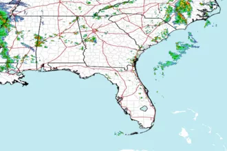
 Southeast Radar