Stonington ME to Port Clyde ME Marine Forecast
| Tonight...Se Winds 10 To 15 Kt With Gusts Up To 20 Kt, Becoming Ne 5 To 10 Kt Late This Evening, Then Becoming N After Midnight. Seas 3 To 4 Ft. Wave Detail: S 3 Ft At 7 Seconds And E 2 Ft At 3 Seconds. A Chance Of Showers Early This Evening, Then A Slight Chance Of Showers Late This Evening And Early Morning. Patchy Fog Late This Evening. Vsby 1 Nm Or Less Late This Evening And Early Morning. |
| Thu...N Winds 10 To 15 Kt With Gusts Up To 20 Kt. Seas Around 3 Ft. Wave Detail: S 3 Ft At 6 Seconds And Ne 2 Ft At 4 Seconds. |
| Thu Night...Ne Winds 10 To 15 Kt With Gusts Up To 20 Kt. Seas 2 To 4 Ft. Wave Detail: Ne 3 Ft At 6 Seconds And S 2 Ft At 6 Seconds. |
| Fri...Ne Winds 10 To 15 Kt With Gusts Up To 25 Kt. Seas 2 To 4 Ft. Wave Detail: Ne 4 Ft At 6 Seconds. |
| Fri Night...Ne Winds 10 To 15 Kt With Gusts Up To 20 Kt. Seas 2 To 3 Ft. Wave Detail: Ne 3 Ft At 6 Seconds. |
| Sat...Ne Winds 10 To 15 Kt With Gusts Up To 25 Kt. Seas 2 To 4 Ft. Wave Detail: E 3 Ft At 6 Seconds. |
| Sat Night...Ne Winds Around 10 Kt. Seas 3 To 5 Ft. A Chance Of Showers After Midnight. |
| Sun...Ne Winds Around 10 Kt, Becoming Se In The Afternoon. Seas 4 To 6 Ft. A Chance Of Showers In The Morning. |
| Sun Night...Sw Winds 5 To 10 Kt. Seas 3 To 5 Ft. A Chance Of Showers After Midnight. |
| Mon...Sw Winds 5 To 10 Kt, Increasing To 10 To 15 Kt With Gusts Up To 20 Kt In The Afternoon. Seas 2 To 3 Ft. A Chance Of Showers In The Morning. |
| Mon Night...Sw Winds 10 To 15 Kt With Gusts Up To 20 Kt. Seas 3 To 4 Ft. A Chance Of Showers After Midnight. |
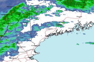
| Area Forecast Discussion National Weather Service Gray ME 632pm EDT Wednesday May 8 2024 Synopsis Several cool and unsettled days are in store as a warm front remains south of most of our forecast area. Widespread showers expected today with a strong storm or two possible this afternoon, mainly across southern NH. Another system follows for the end of the week, bringing more showers into the forecast. The unsettled, showery pattern may continue through the weekend and possibly into early next week. Near Term - Until 6am Thursday Morning Update... Have updated the near term portion of the forecast for the overnight hours. A chilly and raw northeasterly flow continues over the region with temperatures only in the 40s and 50s as of 22Z. The exception would be portions of the Connecticut River Valley which broke out into the sunshine today allowing temperatures to reach the 60s. Patchy fog and scattered showers will dominate the overnight conditions. The highest chance for precipitation will remain over northern portions of the forecast area. All areas will be in the 40s by morning. Prev Disc...Showers from mid level WAA (Warm Air Advection - the movement of warm air) exiting the CWA (County Warning Area) over the next hour or, with warm sector above the inversion moving in late afternoon early eve. This leads to another round showers, more convective and probably more scattered late today. Some thunder is being seen in some of these cells in VT, but expect them to flatten as the cross the CT valley. The best chance for a TSRA will be across SW NH, perhaps as far E as KMHT/KASH. I think there’s a very small chance that a strong storm moves into Cheshire county through about 7 PM, with maybe some hail and some strong winds. Otherwise, between the onset of rain, and the development of onshore flow temps in most places have fallen off morning maxes and now in the upper 40s to low 50s. Parts of the CT valley are the exception where the rain has ended, the clouds have thinned just a bit and the winds are more S-SW, so there temps may warm a few more degrees and top in in the 60-65 range. For tonight, the showers in the warm sector and eventually along the cold front should end by or around midnight. With mainly cloudy skies hold in through the night. NNE flow develops behind the front, during the pre-dawn hours, and this will help clear some places of the low clouds and fog, but the marine layer will stay strong , especially closer to the coast, and that front will not show mixing until after sunrise. Mins will be in the 40s, lower in the mtns and upper in S NH. Short Term - 6am Thursday Morning Through Thursday Night Very weak surface high moves through on Thu, but low to mid level flow becomes stagnant, so it will be tough to clear things out, and skies stay mainly cloudy, although the most sun will be found in the E zones. Still, the NNE flow will at least keep the winds from being onshore, so it looks like temps will stay a little warmer through the day with maxes mostly in the mid to upper 50s. However, except for the exception of a few showers in the mtns, it should stay dry through the day. Thu night stay cloudy, with weak surface low passing S of New England. This brings a chance of some showers working into the S half of NH after midnight. , but it should remain dry for the rest of the CWA, as that NNE flow helps keep dry air in place. It'll be a little cooler Thu night with lows ranging from the upper 30s in the ME mtns to the low to mid 40s in the S. Long Term - Friday Through Wednesday Model guidance has overall persisted with a drier trend for Friday and Saturday with high pressure remaining more in control over our area with a south and eastward trend in an area of low pressure moving off the Mid-Atlantic coast. Still, expect mostly cloudy skies for southern and western areas on Friday with these areas also seeing the higher (30-40%) shower chances. More breaks are expected in the clouds farther north and east with lower shower chances (20%) due to more dry air aloft for Friday. For Saturday, some energy aloft will be crossing overhead to aid in shower development, but lingering dry air aloft should keep shower coverage low. A better chance for additional rain showers arrives Saturday night into Sunday as a more amplified wave moves across New England, but amounts are expected to be light with maybe 0.10-0.25" of rain, per ensemble guidance. Going into early next week, low-level southerly flow is expected to bring a return to warmer temperatures with perhaps another wave or two giving us more showers. However, there is poor agreement on the among models in resolving these waves, so I have left in the NBM slight chance/chance showers. Marine Short Term Winds/seas pick up from the NE late tonight through Thu evening, and should see gusts in the 20-25 kt range, especially Thu aft/eve, but should mostly stay below SCA (Small Craft Advisory) levels. Long Term Winds will be out of the east or northeast on Friday with high pressure NE of the waters and emerging low pressure near the Mid-Atlantic coast. This low will begin to lift to the northeast Friday night into Saturday but is expected to pass east of the waters. However, depending on its proximity to the waters, it could bring a period of SCA (Small Craft Advisory) level wind gusts Fri night through Saturday. Even though showery weather may continue into Saturday, winds and seas look to subside. A return to more southerly flow looks to occur next week, but it's uncertain as to whether it will increase enough for SCA (Small Craft Advisory) levels at this time. Tides / Coastal Flooding High astronomical tides combined with around 0.5 feet of storm surge may push water levels to around minor flood stage around the time of high tide late this evening/tonight and again Thursday night. A Coastal Flood Advisory has been issued for tonight. NOAA Gray/Portland ME Office - Watches - Warnings - Advisories ME...Coastal Flood Advisory from 11pm this evening to 2am EDT Thursday for MEZ023-024. NH...Coastal Flood Advisory from 11pm this evening to 2am EDT Thursday for NHZ014. Marine None. |
 Portland ME Radar
 Northeast Radar