Suwannee River to Apalachicola FL from 20 to 60 NM Marine Forecast
| Overnight...South Winds 5 To 10 Knots. Seas Around 2 Feet. Wave Detail: South 2 Feet At 6 Seconds. Protected Waters A Light Chop. |
| Wednesday...South Winds 10 To 15 Knots. Seas 2 To 3 Feet. Wave Detail: South 3 Feet At 6 Seconds. Protected Waters A Moderate Chop. |
| Wednesday Night...South Winds 10 To 15 Knots. Seas 2 To 3 Feet. Wave Detail: South 3 Feet At 5 Seconds. Protected Waters A Moderate Chop. |
| Thursday...South Winds 10 To 15 Knots. Seas 2 To 3 Feet. Wave Detail: South 3 Feet At 5 Seconds. Protected Waters A Moderate Chop. |
| Thursday Night...Southwest Winds 10 To 15 Knots. Seas 2 To 3 Feet. Wave Detail: South 3 Feet At 6 Seconds. Protected Waters A Moderate Chop. A Chance Of Showers With A Slight Chance Of Thunderstorms After Midnight. |
| Friday...Southwest Winds 10 To 15 Knots, Increasing To 15 To 20 Knots In The Afternoon. Seas 2 To 4 Feet. Wave Detail: Southwest 4 Feet At 6 Seconds. Protected Waters Choppy. A Chance Of Showers With A Slight Chance Of Thunderstorms. |
| Friday Night...West Winds 15 To 20 Knots, Becoming North After Midnight. Seas 3 To 4 Feet. Protected Waters Choppy. A Slight Chance Of Thunderstorms. A Chance Of Showers, Mainly In The Evening. |
| Saturday...North Winds 10 To 15 Knots, Becoming Northwest In The Afternoon. Seas 2 To 3 Feet. Protected Waters A Moderate Chop. |
| Saturday Night...Northwest Winds Around 10 Knots, Becoming North After Midnight. Seas Around 2 Feet. Protected Waters A Light Chop. |
| Sunday...Northeast Winds Around 10 Knots, Becoming East In The Afternoon. Seas Around 2 Feet. Protected Waters A Light Chop. |
| Sunday Night...Southwest Winds 5 To 10 Knots, Becoming North After Midnight. Waves 1 Foot Or Less. Protected Waters A Light Chop. A Slight Chance Of Showers And Thunderstorms After Midnight. Winds And Waves Higher In And Near Thunderstorms. |
| Area Forecast Discussion National Weather Service Tallahassee FL 858pm EDT Tuesday May 7 2024 ...New Issued at 855pm EDT Tuesday May 7 2024 No major changes were needed on this shift. Fog chances look likely once again towards the early morning hours Wednesday. Some areas may see the potential for dense fog, especially in portions of the Florida Panhandle and Big Bend. These conditions are expected to lift around 9-10am EDT Wednesday morning. Another quiet weather day is on tap for Wednesday across the region. Near Term (Through Wednesday) Issued at 317pm EDT Tuesday May 7 2024 The region will remain under the influence of high pressure tonight and on Wednesday. The main concern will be the potential for another round of fog late tonight into Wednesday morning. Confidence is highest in the FL Counties (particularly the Big Bend) into the I-75 corridor of GA. On Wed, cannot rule out an afternoon shower northwest of the FL Big Bend, such as the SE AL counties, but Probability of Precipitation are NIL for now given the aforementioned ridging. A warm and humid pattern continues with lows around 70 tonight and highs around 90 on Wednesday. .SHORT TERM... (Wednesday night through Friday night) Issued at 317pm EDT Tuesday May 7 2024 An upper level low extending over the central plains will be traversing east-northeast through the day Thursday. Over the southeast U.S., the upper level ridge will be flattening while the aforementioned upper level trough moves east. Ahead of the trough, at the surface, a cold front is forecast to march its way east across the Apalachians and southeast Thursday into Friday. Ahead of the front, scattered showers and thunderstorms are expected to develop into a MCS (Mesoscale Convective System, a complex of thunderstorms which becomes organized on a scale larger than the individual thunderstorms) with damaging wind gusts, hail, and a few tornadoes may be possible. The upper level support for Thursday afternoon is expected to lift to the north, allowing for these storms to possibly weaken as they enter into our region. There will be short calm before another MCS makes its way (due to a shortwave perturbation) early Friday with the same severe threats, but is more likely to hold together. The Storm Prediction Center has highlighted areas along and north of I-10 in a Slight (2 of 5) risk for severe weather for Thursday night into Friday morning. The parameters for Thursday night into Friday morning are favorable as we will be in the right- entrance region of the jet stream, shear values will range 30-40 kts, and the instability will be around 2000 J/kg. It is also important to note that with PWATs (Precipitable Waters) approaching 2 inches and the east to west line in which the expected storms will be along the front, the WPC has placed a Marginal (1 of 4) risk for excessive rainfall across our region for Thursday through Friday. Probability of Precipitation for Thursday begin to increase during the afternoon hours with a 40-60 percent chance for our SE Alabama counties and SW Georgia counties. Our Florida counties will have a 30 percent chance and below. Friday's chances increase for the entire CWA (County Warning Area) with a 50-80 percent chance area- wide Friday morning into the afternoon. The cold front is expected to complete its passage through our region during the day on Friday. Temperatures during this term will have highs in the low 90s on Thursday and cooling to the low 70s Thursday night. Friday's highs will be in the low-mid to upper 80s, with the warmer temps along and south of I-10. Friday night's lows will be in the upper 50s to low 60s. Long Term (Saturday through Monday) Issued at 317pm EDT Tuesday May 7 2024 The front has cleared and a surface high will begin building in behind the front. Upper level ridging will soon be building to the west over the weekend and we can expect seasonal temperatures with highs in the low to mid 80s and morning lows in the upper 50s to low 60s. We can expect dry conditions through Monday, except for the daily seabreeze showers and thunderstorms. Marine Issued at 317pm EDT Tuesday May 7 2024 A high pressure ridge will extend from from south of Bermuda across the Florida Peninsula through Thursday. Gentle southerly breezes will slowly increase to moderate southerlies as we move through the middle of the week. Chances for showers and thunderstorms will increase Thursday night into Friday night as a cold front approaches. The front is expected to pass the waters Friday night with northwest winds in its wake. Seas will generally be 2 to 3 feet this week. Fire Weather Issued at 317pm EDT Tuesday May 7 2024 The next chance of wetting rains will be north of I-10 on Thursday and across much of the area on Friday. The main concern will be pockets of high dispersion across much of the region on Wednesday and Thursday afternoons. Daytime highs climb into the lower 90s away from the immediate coast each afternoon through Thursday with heat indices pushing into the middle 90s. Hydrology Issued at 317pm EDT Tuesday May 7 2024 Heavy rainfall is possible Thursday and Friday, hence the WPC highlighting our region in a Marginal (1 of 4) risk for excessive rainfall. This could lead to localized flash flooding, particularly in urban and low-lying areas. Rivers are currently in good shape, and we are not expecting riverine flooding at this time. NOAA Tallahassee FL Office: Watches - Warnings - Advisories FL...High Rip Current Risk until 10pm EDT /9pm CDT/ this evening for FLZ108-112-114-115. GA...None. AL...None. GM...None. |
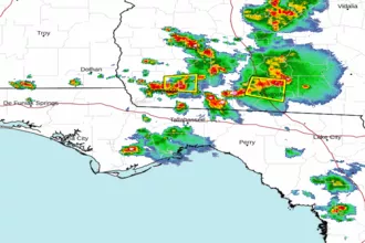 Tallahassee FL Radar
 Gulf Radar