Tangier Sound and the inland waters surrounding Bloodsworth Island Marine Forecast
| Rest Of This Afternoon...Sw Winds 10 Kt. Waves 1 Ft. Isolated Showers And Tstms. |
| Tonight...W Winds 5 To 10 Kt. Waves 1 Ft. Scattered Showers. |
| Thu...Sw Winds 5 To 10 Kt...Becoming Se Late. Waves 1 Ft. Showers Likely With A Chance Of Tstms. |
| Thu Night...E Winds 10 To 15 Kt. Waves 1 Ft. A Chance Of Showers. |
| Fri...N Winds 10 To 15 Kt. Waves 1 Ft. A Chance Of Showers. |
| Fri Night...N Winds 10 To 15 Kt With Gusts To 20 Kt. Waves 1 Ft. |
| Sat...W Winds 5 To 10 Kt...Becoming Se 10 To 15 Kt In The Evening, Then Becoming Sw After Midnight. Waves 1 To 2 Ft. A Chance Of Showers Through The Night. |
| Sun...Nw Winds 10 To 15 Kt. Waves 1 Ft. Winds And Waves Higher And Visibilities Lower In And Near Tstms. |
| Area Forecast Discussion National Weather Service Baltimore MD/Washington DC 924pm EDT Wednesday May 8 2024 Synopsis A backdoor cold front will move into northern areas overnight before stalling on Thursday. A second stronger cold front will move across the area Thursday night. A third cold front will move across the area early on Sunday. Near Term - Until 6am Thursday Morning Any convection managed to stay south of our CWA (County Warning Area) this afternoon and should continue to do so through and a little past midnight tonight. Models indicate that there could be a couple of showers or a thunderstorm or two move into western parts of the Virginia Piedmont and central Shenandoah Valley sometime after 3am and linger through daybreak Thursday. Short Term - 6am Thursday Morning Through Friday Night Showers and perhaps thunderstorms will spread to the east Thursday with additional showers and thunderstorms expected to develop later Thursday morning and during the afternoon. The risk for severe thunderstorms still appears to be focused across our southern zones on Thursday. Isolated thunderstorms that could develop along the Mason-Dixon could become strong as well as a low pressure system at the surface arrives from the west and along the frontal boundary. More showers appear likely Friday as upper trough crosses the area. Long Term - Saturday Through Wednesday Longwave troughing will persist over the Mid-Atlantic and Northeast states through the weekend before pushing offshore early next week. Saturday will start out dry in the wake of a departing shortwave trough pushing offshore. Skies should trend mostly sunny to mostly cloudy as the day progresses with the bulk of the cloud cover especially for the VFR conditions are expected to prevail through the weekend at all terminals. front half of the day confined to areas along and west of the Blue Ridge. As one shortwave trough departs, another will follow from the Ohio River Valley late Saturday night and into the day Sunday. Cloud cover will increase from west to east across the forecast area late Saturday afternoon and into Sunday. Precipitation chances will also increase as well with large scale ascent overspreading the region. The bulk of any shower or thunderstorm activity Saturday will mainly be confined along and west of the Blue Ridge during the morning and afternoon hours. This activity will spread eastward with time late Saturday into Sunday. Coverage will remain scattered across the area both days with more numerous to widespread activity Saturday night into Sunday as the upper trough axis passes overhead. With the added cloud cover and west to northwesterly flow expect weekend high temperatures in the upper 60s and low 70s. Low temperatures will fall back into the upper 40s and low to mid 50s. Rain chances finally decrease Monday as upper level troughing progresses east of the region. High pressure will briefly build over the region from the south before shifting offshore midweek. With the high shifting offshore Tuesday expect diurnal chances for showers and thunderstorms to return to the region. High temperatures Monday will reach into the low to mid 70s with mid to upper 70s expected on both Tuesday and Wednesday. Lows will remain in the upper 40s and low to mid 50s. Marine Possible SCA (Small Craft Advisory) conditions all weekend, but winds and waves could be higher near thunderstorms especially across southern waters. Low end SCA (Small Craft Advisory) level winds in west to southwest flow are expected Saturday before turning toward the northwest Sunday. SCA (Small Craft Advisory) level winds will continue into Monday especially over the open waters of the bay and tidal Potomac under southeasterly flow. NOAA Baltimore MD/Washington DC Office: Watches - Warnings - Advisories DC...None. MD...None. VA...None. WV...None. Marine None. |
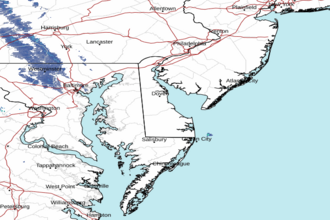 Dover DE Radar
 Northeast Radar